Hong Kong topographic map
You can find on this page the Hong Kong topographic map to print and to download in PDF. The Hong Kong elevation map present the topography, river and relief of Hong Kong in China.
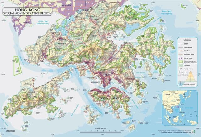
Hong Kong elevation map
The Hong Kong topographic map shows elevation, hills and landforms in Hong Kong. This elevation map of Hong Kong will allow you to know topography, river and relief of Hong Kong in China. The Hong Kong topographic map is downloadable in PDF, printable and free.
Most of the territory urban development exists on Kowloon peninsula, along the northern edge of Hong Kong Island, and in scattered settlements throughout the New Territories. The highest elevation in Hong Kong is at Tai Mo Shan, 957 metres (3,140 ft) above sea level as its mentioned in Hong Kong elevation map.